Tracing Riots & Cases of Physical Violence
Current Solutions - saving the world gone wrong?
The number, scope, and severity of violent events around the world are increasing, and globally critical infrastructures now see over 2000 violent events per week . According to the United Nations, although the frequency of war deaths had declined since 1946, “conflict and violence are currently on the rise”, costing the World hundreds of victims and up to $2 billion a year .
Existing Emergency Alerting Systems rely on satellite services and security (CCTV) cameras, creating a lag between the events depicted in satellite coverage/face recognition and an actual alert. This lack of real-time intelligence coverage creates the space for potential incidents, insurance claims, and legal disputes.
Furthermore, existing Predictive Policing Machine Learning solutions, although continuously developed, are based on Facial Recognition, which is proven to be less effective on darker skin tones. Therefore, the system has an almost intrinsic tendency toward racial profiling.
This is a guest blog from our client applying text-based geolocation prediction to Social Media in the field of Physical Welfare, resolving the problem of the current system.
Social Media for the win
Facebook alone has over 3B monthly users, and social media has become one of the most accessible sources of information, turning the consumers (users) into data producers.
Social media analysis provides faster processing speeds than satellite-based emergency systems, and we propose that on-the-ground streaming data can serve as the main basis of geospatial risk analysis. Using social media as a data source and NLP as an analytics tool can provide a certain extent of anonymity and accessibility allowing for social, economical and racial inclusivity.
Since text-based analysis requires relevant Natural Language Processing tools, we suggest a combination of:
- Event Classification, which is a tool that identifies texts pertaining to riots and cases of physical violence.
- Geotagging AI geolocation tools to predict the user’s location.
The combination of these two tools would provide analytics with a live low-latency alerting system on related reports in proximity to a given area of interest.
A Showcase - Capitol Riots
Applying Geotagging AI predictive analytics combined with existing NLP solutions to live social media posts provides:
- Neighborhood-level event coordinates
- Time-stamped text data
- Event descriptions
The map below shows an analysis of incidents of physical violence across the US over the past 2 years.
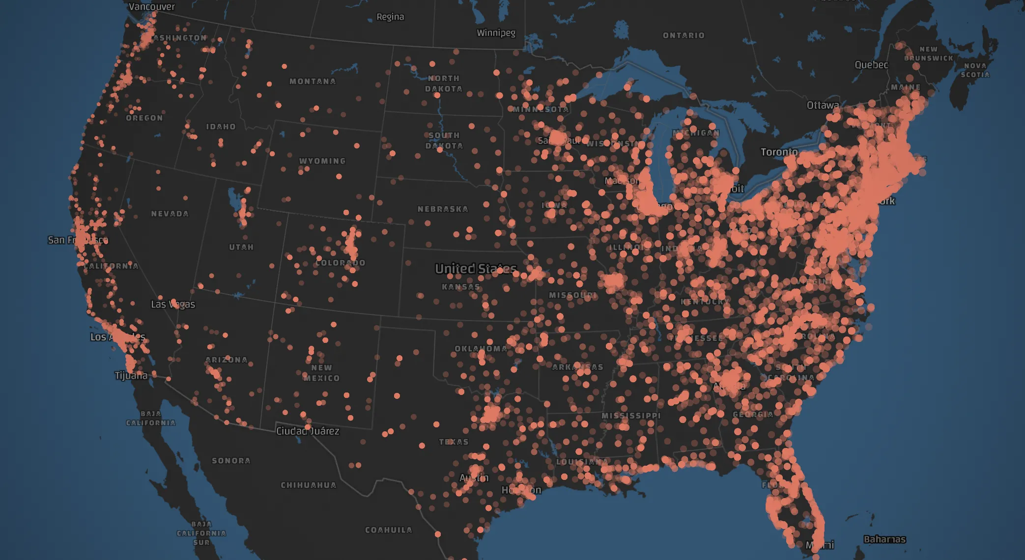
Looking at the example of the Capitol Riots, social media proves to offer timely general media coverage of the events January 6th onwards; the related spike in Twitter and Reddit activity started in the evening of January 5th.
See a Reddit post at 11am, January 5th:

And a Twitter post with similar content:
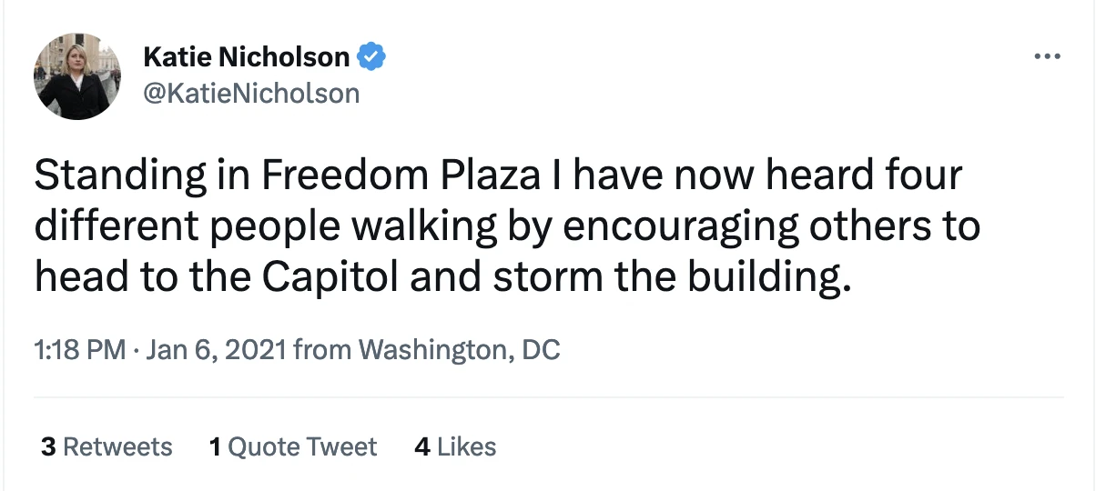
Numerous posts like the two above signaled the involved individuals, their locations, and the direction of their movements, alerting our systems in the evening preceding the actual events and even preceding global media coverage.
Were the same analysis applied to other regions and social media posts, a high-precision and low-latency alerting system could be triggered in the event of other incidents of physical violence.
